FYI.

This story is over 5 years old.

Tech

Where Is the Center of Each United State?

"Meet me in the middle."
Map by the author

(Update: An earlier version of this map containing some inaccuracies has been replaced.)

Have you ever spent an extended period of time trying to find, or simply meditating on the center of an object? You know, that sweet spot, where if you picked it up and placed it square on your nose, it would balance perfectly. I've recently found myself obsessed with the concept, but I assure you it has nothing to do with becoming a street performer. The aspect I've become obsessed with is how it applies to the 50 states (and DC). So, in a very OCD-satisfying manner, I made a map:

Advertisement

These spots may be abstract, and solely the musings of geographers. And you can argue all you want that centralization in geography is a thing of the past. Of course, these points have nothing to do with people. Rather, they're just the most central locations of each state's geographical boundary. (However, the population center of West Virginia, did at one point in 1860, overlap the geographical center.) Regardless of the scholarly value, I'd argue that these locations are pleasing to the mind, if not downright interesting to think about for a variety of reasons:

I know I touched on this above, but if you try to balance a paper cutout of your state on a needle, this is the spot you should utilize.

Sometimes, the middle really is the middle of everything, as is the case for Oklahoma City. A natural question arises: Why did this city end up so equidistant to its borders?

More often, the middle seems to be the middle of nowhere.

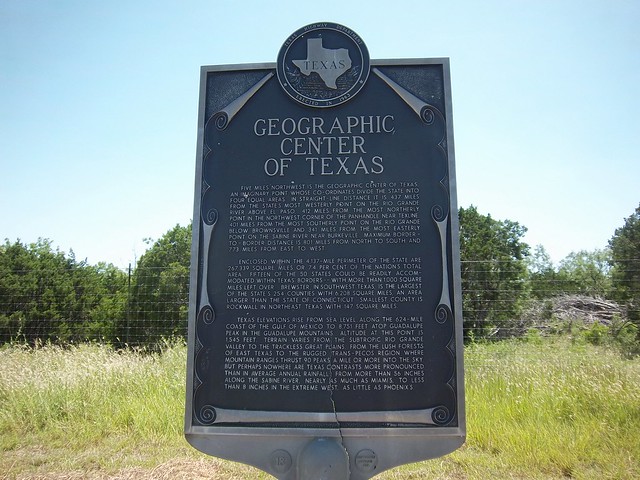
Image via Flickr

If you visit one of these places in real life, there's likely to be a nerdy sign like this.

And in the center, you are least likely to be offended by the diffusion of neighboring and surrounding territories and outsider thoughts.

Ahh, take me to that center.

@danstuckey