

A new report released by the Satellite Sentinel Project, a human rights campaign started by George Clooney, states that there is strong evidence of the buildup of infrastructural and logistical capabilities with the potential to restrain civilian mobility or to provoke aggression against the civilian population in the Nuba Mountains region of South Kordofan in Sudan, and is issuing a human security alert for that region.Military actions like this are unfortunately being carried out all the time worldwide. What makes this case interesting is that the story is being broken, not by government agencies or from hazy reports on the ground, but by a group of private analysts using the wealth of satellite imagery now available to build awareness for a human rights campaign.John Prendergast, co-founder of the Enough Project had this to say about the recent mobilization:"With only two months left until the expected start of the rainy season, the Sudan army has a limited window to launch a full-scale assault on the Kauda Valley and the surrounding region where the majority of the remaining Nuba people live. As they did with the Ngok Dinka in Abyei and with the Fur and Zaghawa in Darfur, the Khartoum regime is driving the Nuba people out of their homelands in order to remove the support base for the rebel Sudan People's Liberation Army – North."The report, using images collected by DigitalGlobe, and analyzed by the Harvard Humanitarian Initiative shows the building up of roads and the deployment of military vehicles around the Nuba Mountains region in a pattern that closely mimics the Sudan Armed Forces (SAF) invasion of Abyei in May of last year. SSP’s alert comes on the heels of a statement released by Sudan's President Omar Al-Bashir on November 23, 2011 where he reportedly pledged that "the celebration for wiping out the rebellion in South Kordofan State will be through the coming final battle in Kauda area."SSP’s report, thanks to advanced photographic technology may be useful in detecting human rights violations before they occur, but there’s still something extremely disquieting about seeing calculated conflict unfold through satellite imagery. Try your hand at analyzing some of the choice images here, and check out the rest at the Enough Project’s Flickr page.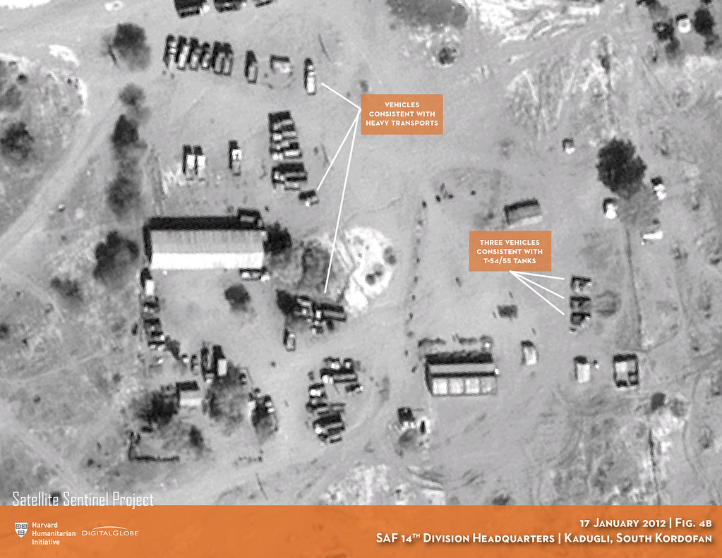

Advertisement
Advertisement
These images taken from November 2011 to January 2012 show road construction vehicles extending and leveling the the Talodi Airstrip in Talodi, South Kordofan, Sudan
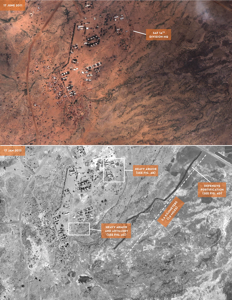
Satellite images taken by DigitalGlobe show the dispatching of Heavy Armored vehicles at SAF 14th Division Headquarters. The array of documented vehicles include T54/55 Tanks and helicopters. This image was taken in Kadugli, South Kordofan, Sudan on January 13, 2012
These two images taken on May 21, 2011 and January 14, 2012 respectively of the village Buram in South Kordofan shows apparent civilian displacement, and the dismantling of structure over time. Buram is known by the Sudanese government to be a stronghold for SPLM (Sudan Peoples’ Liberation Movement) and a known enemy of the Sudanese government.