
Just a quick suggestion: follow NASA on twitter. Today, scientists from its IceBridge mission embarked on an 11-hour flight over West Antarctica, and they live-tweeted the whole thing. With pics and a Q+A session to boot.IceBridge is the largest survey of Earth’s polar ice cover ever attempted. According to NASA, over six years, it will “yield an unprecedented three-dimensional view of Arctic and Antarctic ice sheets, ice shelves and sea ice” and will “provide a yearly, multi-instrument look at the behavior of the rapidly changing features of the Greenland and Antarctic ice.”In addition to satellite monitoring from the aptly named ICE, that means plane-based missions, too. Like today’s trip to the Ronne Ice Shelf.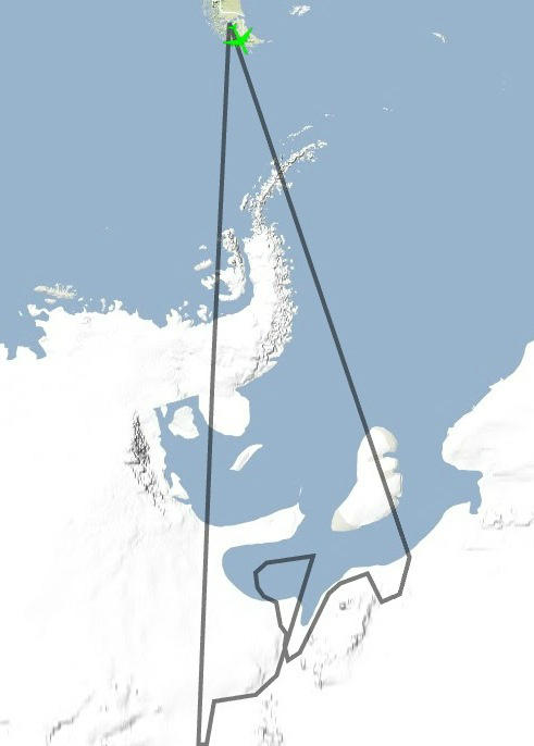 They started early.Meet the crew.They outlined their flight path:Replete with helpful geographical contextualizers.The NASA scientists discuss the mission at length:During the Q+A, they answered a few questions from followers, including mine:And you get a sense of the scenery—they can’t post many pics live, because it turns out that there just isn’t enough bandwith in the middle of Antarctica to upload hi-res photos.And how’d it all go? Better than expected.There you have it. An entire arduous Antarctic science expedition laid out, in real-time, in a few hundred characters. Not a bad way to kill an afternoon.
Advertisement